Arduino GPS Project
Learning a geospatial stack, bringing in my love for microcontrollers and IoT
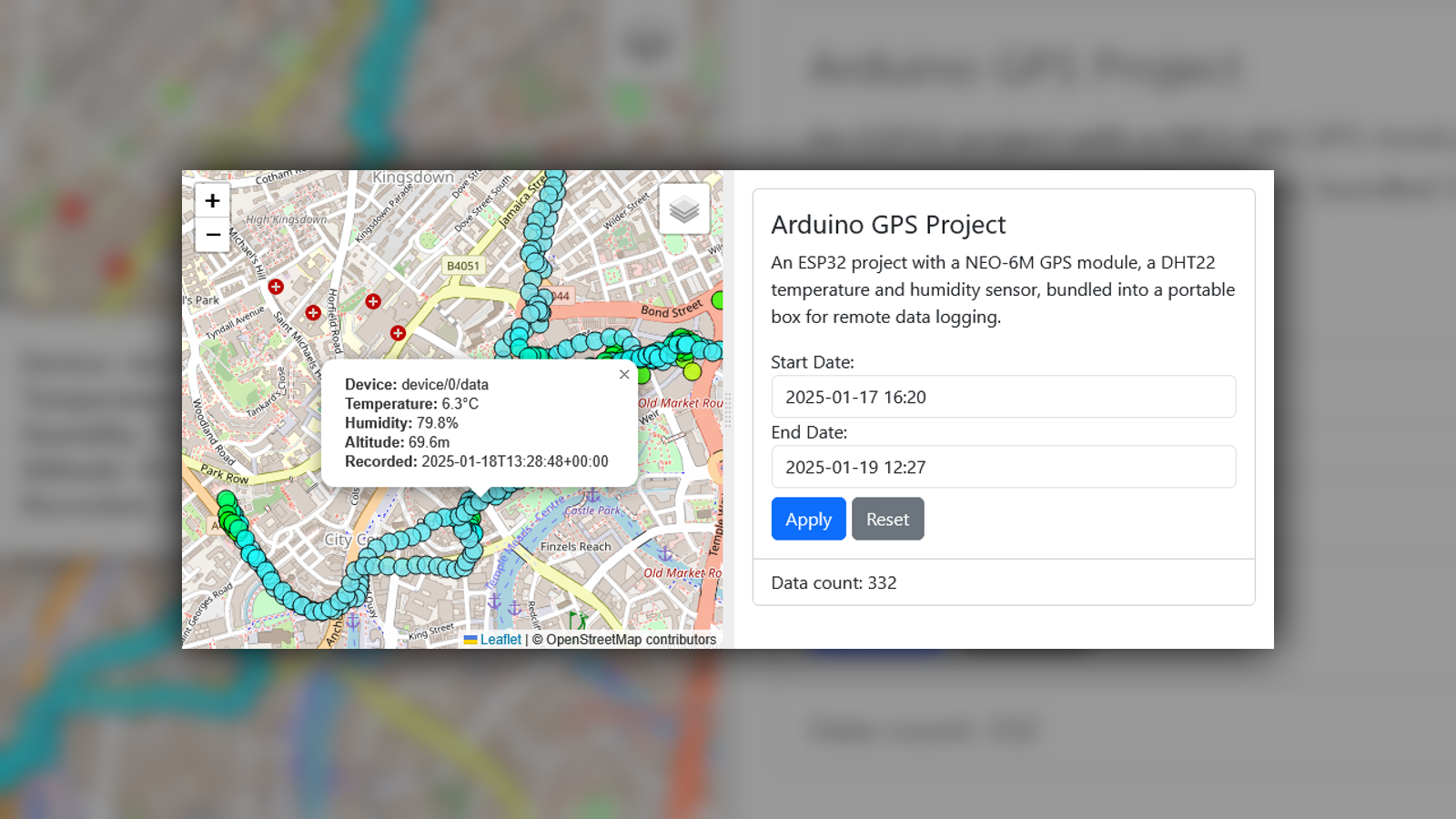
This project is an ESP32-based GPS and sensor tracking system that logs location and environmental data, then visualises it on a Flask webserver with an interactive Leaflet map.
Features
- ESP32 hardware
- NEO-6M GPS module: Captures location data
- DHT22 sensor: Measures temperature and humidity
- SD card module: Stores data while offline, provides configuration options
- Portable Battery and Project case: Designed for outdoor use and mobility
- Backend
- Python Flask webserver: Serves the frontend and data endpoints
- PostgreSQL with PostGIS: Stores location data and performs spatial queries
- Frontend
- Leaflet.js: Displays location data on an interactive map
- Bootstrap: Provides clean UI with rapid prototyping
- flatpickr: Date picker for filtering data
- TypeScript, HTML, CSS: Frontend languages built with Webpack
A project for me to learn a geospatial stack and build a full-stack application from scratch, bringing in my love for microcontrollers and IoT.
Photos
 |
|---|
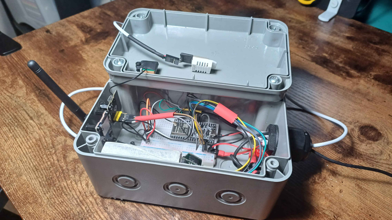
| The project in its box, DHT22 sensor on a long wire |
 |
|---|
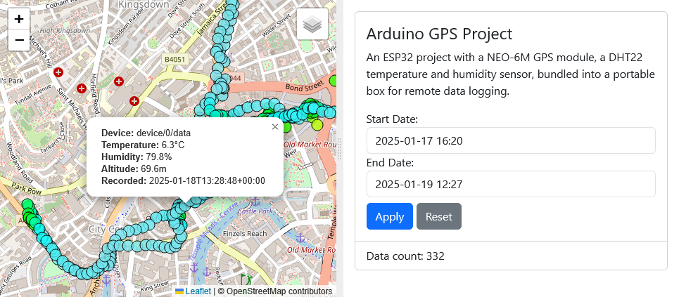
| The Flask webserver displaying the map and data |
 |
|---|
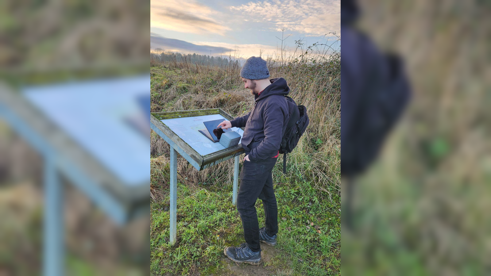
| Out in the field collecting data and checking it is functioning correctly |
 |
|---|
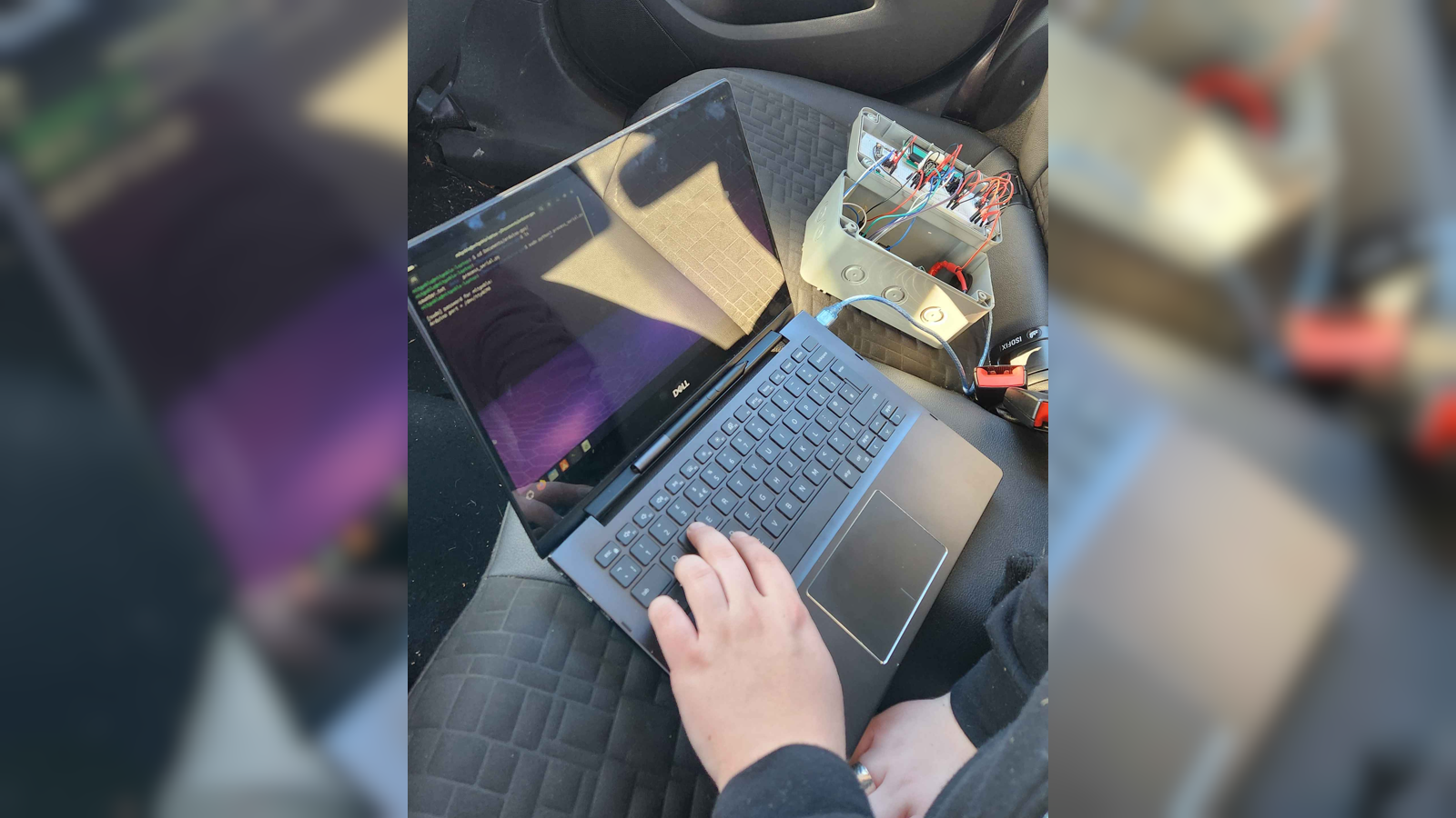
| Collecting data in my car, connected to laptop for debugging |
Copyright 2018 - 2026 Benjamin Dodd. All Rights Reserved.